Storm Caroline’s progress shown from space
Published On Thu 7 Dec 2017 by Dominic Younger
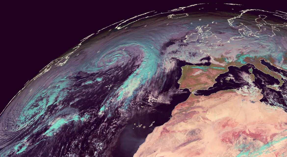
Images captured by the University of Dundee Satellite Receiving Station over the last 72 hours show the progress of Storm Caroline as it passes over the British Isles.
The images captured by the Meteosat satellite at 15:00 GMT on 05/12/2017, 12:00 GMT on 06/12/17 and most recently by the MetOp-B satellite at 10:15 GMT on 07/12/2017 demonstrate that while the UK is dwarfed by the oncoming Caroline, named by the Met Office on Tuesday, 5 December, it is largely passed over.
The most recent images captured on Thursday, 7 December by the MetOp-B satellite shows the eye of the storm centered over the Shetland Islands.
For media enquiries contact:
Dominic Glasgow
Media Relations Officer
University of Dundee
Nethergate, Dundee, DD1 4HN
Tel: +44 (0)1382 385131
Email: d.w.glasgow@dundee.ac.uk