Plans to save a crucial Saudi Arabian oasis from being buried under drifting desert sand are being investigated half a world away at the University of Dundee where remote sensing technology using satellite images is being used to map the dunes and identify the major areas of risk.
Sand drift has buried many villages and springs over history in the area of the AL-Hassa oasis. The largest oasis in Saudi Arabia, with a population of one million, the AL-Hassa is under threat from the migration of the Jafurah Sand Sea which is expected to bury it. If however, the most active dunes and those which present the greatest hazard to the oasis settlements could be identified, a programme of measures to control and hold the sand movements could be implemented.
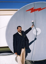
Drawn by the international reputation of the University of Dundee's work in remote sensing, postgraduate student Mohammed AL-Rowili, the son of a well connected Saudi Arabian family, is working on methods of dune mapping using data drawn from a range of sources over time and applying formulae to satellite images to identify how and where the active sand is.
He said: "The development of methods for controlling sand movement has enormous importance. .Sand movement is a very active process which interferes with the vital aspects of urbanised, industrial and agricultural land. With the rapid growth of the AL-Hassa oasis and the major development programmes under progress, the problem is very acute."
Mohammed AL-Rowili's study, now into its second year, will create a sand hazard index, mapping the dunes, identifying their types - their degree and direction of movement and the risks they pose - and go on to recommend the best solutions using local resources. Planting and terracing programmes are among the solutions currently used in such areas. /ends
Notes for Editors
The Centre for Remote Sensing and Environmental Monitoring (CRSEM) is a
multi-disciplinary research centre within the Faculty of Science and
Engineering at the University of Dundee. The Centre's primary role
includes:
*understanding and modelling the physical processes involved in the
acquisition of remote sensing data
*design and development of remote sensing instrumentation including airborne and space-borne instruments,
*research and development of satellite on-board processing and data-handling systems for Earth observation and planetary missions,
reception, archiving and dissemination of data from existing remote sensing satellites, interpretation of remote sensing data.
Contact Mohammed AL Rowili 01382 345025
See http://www.dundee.ac.uk/elecengphysics/remsns.htm